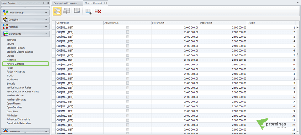
The Mineral Content panel allows you to define mineral content restrictions for destinations, applying a lower and upper limit for each material, destination, area, phase and period.
Tips&Tricks
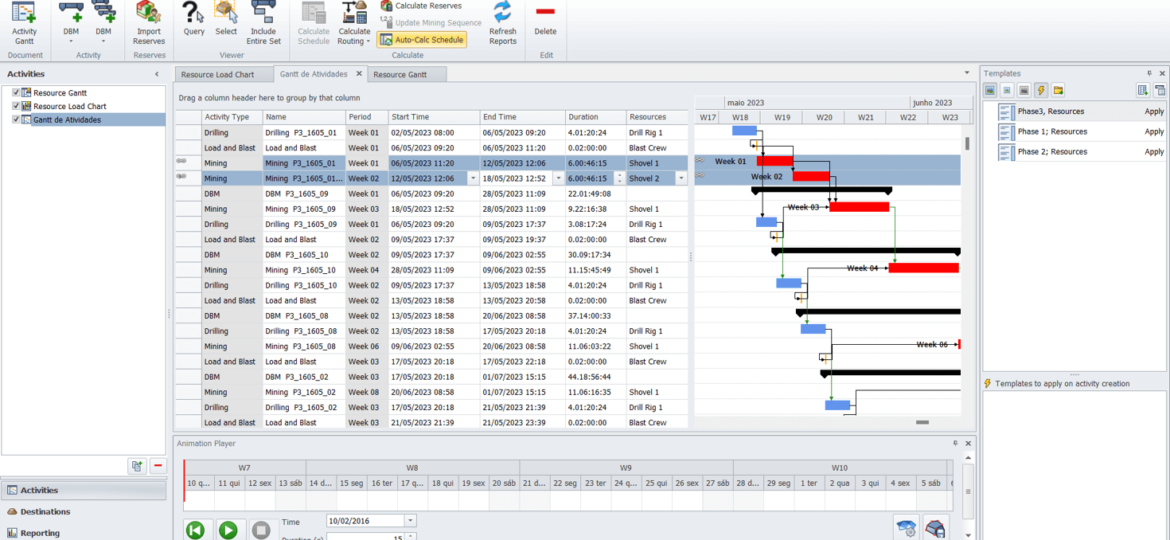
The Split option, located under the Activity menu in MPAS, allows a sequenced activity on your Gantt chart to be split by geometry, mass, percentage or time.

MPSO Shovel Control: Control of excavators in sequencing. Did you know that MinePlan Schedule Optimizer (MPSO) has an option that allows the user to easily control/associate excavators in their project? The Shovel Fleets option, located on the Advanced Constraints tab of the MPSO, allows the user to associate excavators by phases, banks, cuts and periods, in addition to allowing control of the number of equipment to be used. When accessing this tab, the central windows can be used to specify which of the options the equipment will be associated with. In the Properties window, you must select Shovels as the restriction type, and later, specify the periods in which this restriction will be applied and the desired equipment in the Shovels Fleets option. Use the Apply option to confirm it. Figure 1: Advanced Constraints tab – MPSO. After clicking Apply, you can access the Shovel Constraints window and…

Calculated Sample Attributes: Variables calculated in MinePlan Drillhole Manager. Did you know that MinePlan Drillhole Manager is able to perform calculations and store its results in a variable for samples? In today's Tips & Tricks, we'll learn more about the calculated variables of the Drillhole Manager. Calculated variables can be used in a variety of ways to help you with multiple tasks and analyses. To create a calculated field in MinePlan Drillhole Manager, access the project setup area under Project > Setup. From the drop-down menu, select the Calculated Sample Attribute option. The variable must belong to one of the available Coverages, and must be configured according to its purpose. See, in Figure 1, the configuration window of a calculated variable. Figure 1: Configuration of a calculated variable. When creating a variable of this type, you must create a code…

Event types in GeoLogic: The best geological modeling techniques in MinePlan. Did you know that GeoLogic has several predefined event types to aid in the implicit geological modeling process? In today's Tips & Tricks, we'll talk about each of them. When opening GeoLogic, you will immediately notice a band on the upper edge with several event icons (Figure 1). Each one of these icons represents a type of object to be modeled by the software and brings together optimized settings for that. It is up to the user to choose the tool that best represents the desired object to be modeled. Figure 1: GeoLogic interface highlighting the different types of events. In general, it is possible to group events into the following classes: Events with hanging wall and foot wall: stratigraphy, dyke/vein and weathering; Zone events: topography, fault and unconformity; Solid…

Meet Hexagon MinePlan GeoLogic: Implicit geological modeling in MinePlan. Did you know that the MinePlan package has a powerful implicit geological modeling module? In today's Tips & Tricks, we'll talk about it: GeoLogic! GeoLogic is a MinePlan package software capable of creating surfaces and solids, generating a robust and representative three-dimensional model of the geology of a given region. The program uses Radial Basis Functions (RBF) algorithms to model geological bodies from drilling data, trench samples or mining fronts. The results show closed solids, with natural contours and statistical reliability (Figure 1). Figure 1: Differences between explicit (left) and implicit (right) modeling. GeoLogic can be opened under MP3D's Geo Tools menu, presenting a simple and intuitive interface. It allows you to generate events…

MPReserves – Covering between topographies: Practicality to carry out the cubing between two topographies. Did you know that MinePlan has a tool that calculates reserves between two surfaces? With the MPReserves tool, which has its own menu, the user can select two topographies so that the calculation of reserves is carried out using information from the Block Model. Accessing the “Setup Reserves” option, located in the Reserves menu, navigate to the Surface Cuts tab and select the topographies of interest using the Add Surface Cut(s) option. Afterwards, you must specify the position of the topographies in the “Position” column. In addition, in “Surface Name”, the user can change the name of the surfaces, thus customizing the visualization of the results. Figure 1: Surface Cuts tab – MPReserves. Using the Calculate Reserves option, the tool will measure the topographies, generating a dynamic table…

MPSO Block Schedule Coding: Encode the result of Mining Sequencing in the block model. Did you know that MinePlan Schedule Optimizer (MPSO) has an option that allows the user to easily stamp results into the Block Model? The Block Schedule Coding option, located in the Utilities menu, makes it possible to stamp Block Model items with the sequenced periods and destinations to which the materials were sent. After accessing the option, you can, in a simple way, configure the Destinations tab, through the Code column, inserting the desired numeric code that each destination will represent in the Block Model. In the Destination Item option, you must specify the model item into which the values will be encoded. Figure 1: Destinations tab in Block Schedule Coding – MPSO. In the Periods tab, you can specify in the Period Item column the variable of…
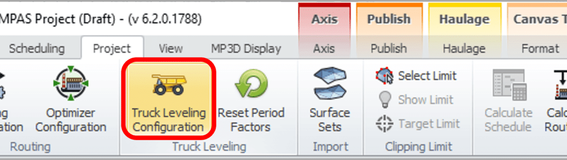
MinePlan Activity Scheduler – Truck Leveling: Practicality in leveling the number of trucks. Did you know that MinePlan Activity Scheduler has a tool that automatically levels the number of transport equipment when distributing material? Short-term planning is one of the main channels of communication between planning and mine operations. The Truck Leveling Tool allows the user to optimize material movement based on the schedule and limit truck over-utilization, automatically reducing excavator productivity. This helps to eliminate equipment overuse and create an effective schedule in a short amount of time, allowing you to analyze and adjust the number of equipment in the fleet to ensure that the target is achieved. To use this tool, click on the Truck Leveling Configuration option located in the Project panel. The tool…

Point Editor: Versatility and precision in creating and editing points. Did you know that MinePlan 3D (MP3D) has a tool that allows you to create and edit points using specific coordinates, relative distance and/or vectors? The Point Editor tool allows you to create/edit points from input of desired coordinates. It works in conjunction with other editing tools, and allows you to create and move points, independent or associated with a line or polygon. The Point Editor is accessed through the Utilities menu. After opening the tool, you should start some editing operation with another tool, such as Create Point, Move Point, Create Polygon or Create Polyline, and the Point Editor will act as an auxiliary tool. For example, when creating a line, you can add the points of that line through the Point Editor. It is possible to add points in a…